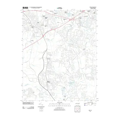
2010 Map of Apex
USGS Topo · Published 2010About this map
Holly Springs and Apex serve as the primary anchors for this region south of Cary, where rapid suburban development is clearly visible. The map records a landscape in transition, with established residential clusters like Knollwood, Claybourne, and Wimbledon contrasting with the remaining agricultural and riparian corridors. Water management is a defining characteristic of the terrain, featuring numerous impoundments such as Bass Lake, Sunset Lake, and MacGregor Downs Lake, many of which are linked by the winding courses of Middle Creek and Swift Creek. Long-standing local identifiers remain, including Bev Jones Crossroads and Feltonville, providing a bridge between the area's rural past and its modern expansion. Notable infrastructure like Apex Peakway and Kildaire Farm Rd outlines the connectivity of these growing communities during the early twenty-first century.
Find a feature on this map
76 named features on this map. Tap any name to fly to it.
Don’t see what you’re looking for? This feature index may not catch every label — zoom into the map to look around manually.
Map Details
Editions of this 2010 Apex Map
This is the sole edition of this map. No revisions or reprints were ever made.
Other maps of this area

1943 · Durham South
USGS Topo · 1:62,500

1943 · Raleigh
USGS Topo · 1:62,500

1951 · Raleigh
USGS Topo · 1:62,500

1951 · Durham South
USGS Topo · 1:62,500

1953 · Raleigh
USGS Topo · 1:250,000

1954 · Raleigh
USGS Topo · 1:250,000

1964 · Lake Wheeler
USGS Topo · 1:24,000

1964 · Angier
USGS Topo · 1:24,000

1964 · Garner
USGS Topo · 1:62,500

1968 · Raleigh West
USGS Topo · 1:24,000