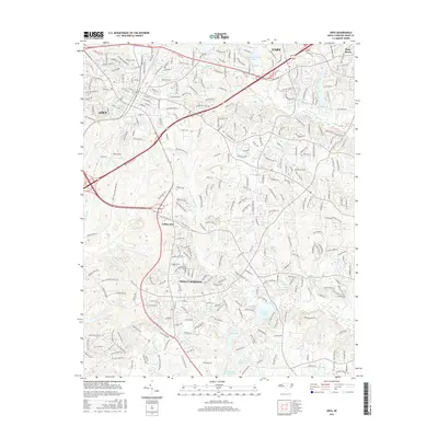
2016 Map of Apex
USGS Topo · Published 2016About this map
Holly Springs and Apex anchor this 2016 study of southwestern Wake County, showing a landscape defined by rapid suburban expansion and a sophisticated network of local waterways. The area is characterized by numerous small reservoirs and ponds, including Sunset Lake, Bass Lake, and the twin Akins Pond Number One and Akins Pond Number Two to the south. These water bodies, along with tributaries like Utley Cr and Middle Cr, are interwoven with modern thoroughfares such as the Apex Peakway and Reunion Creek Pkwy.
Find a feature on this map
30 named features on this map. Tap any name to fly to it.
Don’t see what you’re looking for? This feature index may not catch every label — zoom into the map to look around manually.
Map Details
Editions of this 2016 Apex Map
This is the sole edition of this map. No revisions or reprints were ever made.
Other maps of this area

1943 · Durham South
USGS Topo · 1:62,500

1943 · Raleigh
USGS Topo · 1:62,500

1951 · Raleigh
USGS Topo · 1:62,500

1951 · Durham South
USGS Topo · 1:62,500

1953 · Raleigh
USGS Topo · 1:250,000

1954 · Raleigh
USGS Topo · 1:250,000

1964 · Lake Wheeler
USGS Topo · 1:24,000

1964 · Angier
USGS Topo · 1:24,000

1964 · Garner
USGS Topo · 1:62,500

1968 · Raleigh West
USGS Topo · 1:24,000