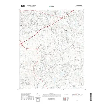
2019 Map of Apex
USGS Topo · Published 2019About this map
Apex and Cary anchor the northern reaches of this Wake County survey, documenting a landscape where suburban expansion meets an intricate system of Piedmont waterways. The map traces the dense network of modern residential developments and transit corridors that have reshaped the area around Feltonville and Holly Springs. Despite the rapid growth, the natural hydrology remains a defining characteristic, with Middle Creek, Swift Creek, and Dutchmans Br weaving through the terrain. Significant local landmarks include the Apex Cem and the Saint Andrew the Apostle Catholic Church Columbarium, providing valuable points of reference for genealogists and local historians. To the south, Fuquay-Varina marks the edge of the sheet near Bass Lake, illustrating the continued southward reach of the Research Triangle's outer ring at the end of the second decade of the 21st century.
Find a feature on this map
368 named features on this map. Tap any name to fly to it.
Don’t see what you’re looking for? This feature index may not catch every label — zoom into the map to look around manually.
Map Details
Editions of this 2019 Apex Map
This is the sole edition of this map. No revisions or reprints were ever made.
Other maps of this area

1943 · Durham South
USGS Topo · 1:62,500

1943 · Raleigh
USGS Topo · 1:62,500

1951 · Raleigh
USGS Topo · 1:62,500

1951 · Durham South
USGS Topo · 1:62,500

1953 · Raleigh
USGS Topo · 1:250,000

1954 · Raleigh
USGS Topo · 1:250,000

1964 · Lake Wheeler
USGS Topo · 1:24,000

1964 · Angier
USGS Topo · 1:24,000

1964 · Garner
USGS Topo · 1:62,500

1968 · Raleigh West
USGS Topo · 1:24,000