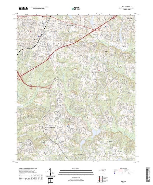
2022 Map of Apex
USGS Topo · Published 2022About this map
The suburban development of southwest Wake County is captured here in the early 2020s, showing the rapid expansion of Apex, Cary, and Holly Springs. The landscape is a dense network of residential subdivisions and major transit corridors like NC 540 and Us 64, yet it retains traces of its rural past. Older community nodes like Feltonville and Piney Plains sit alongside modern landmarks such as the Saint Andrew the Apostle Catholic Church Columbarium.
Find a feature on this map
25 named features on this map. Tap any name to fly to it.
Don’t see what you’re looking for? This feature index may not catch every label — zoom into the map to look around manually.
Map Details
Editions of this 2022 Apex Map
This is the sole edition of this map. No revisions or reprints were ever made.
Other maps of this area

1943 · Durham South
USGS Topo · 1:62,500

1943 · Raleigh
USGS Topo · 1:62,500

1951 · Raleigh
USGS Topo · 1:62,500

1951 · Durham South
USGS Topo · 1:62,500

1953 · Raleigh
USGS Topo · 1:250,000

1954 · Raleigh
USGS Topo · 1:250,000

1964 · Lake Wheeler
USGS Topo · 1:24,000

1964 · Angier
USGS Topo · 1:24,000

1964 · Garner
USGS Topo · 1:62,500

1968 · Raleigh West
USGS Topo · 1:24,000