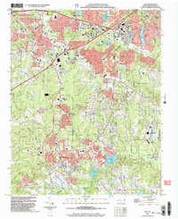
2002 Map of Apex
USGS Topo · Published 2004About this map
The town of Apex serves as the focal point of this 2002 topographic study, showcasing the rapid suburban transformation of Wake County. Detailed street grids including Chatham St and Williams St intersect with the Cary corporate limits, reflecting the expansion that characterized this era. To the south, Holly Springs is depicted alongside recreational and natural landmarks such as Womble Park and the distinct terrain of Hemlock Bluffs State Natural Area.
Find a feature on this map
47 named features on this map. Tap any name to fly to it.
Don’t see what you’re looking for? This feature index may not catch every label — zoom into the map to look around manually.
Map Details
Editions of this 2002 Apex Map
This is the sole edition of this map. No revisions or reprints were ever made.
Other maps of this area

1943 · Durham South
USGS Topo · 1:62,500

1943 · Raleigh
USGS Topo · 1:62,500

1951 · Raleigh
USGS Topo · 1:62,500

1951 · Durham South
USGS Topo · 1:62,500

1953 · Raleigh
USGS Topo · 1:250,000

1954 · Raleigh
USGS Topo · 1:250,000

1964 · Lake Wheeler
USGS Topo · 1:24,000

1964 · Angier
USGS Topo · 1:24,000

1964 · Garner
USGS Topo · 1:62,500

1968 · Raleigh West
USGS Topo · 1:24,000