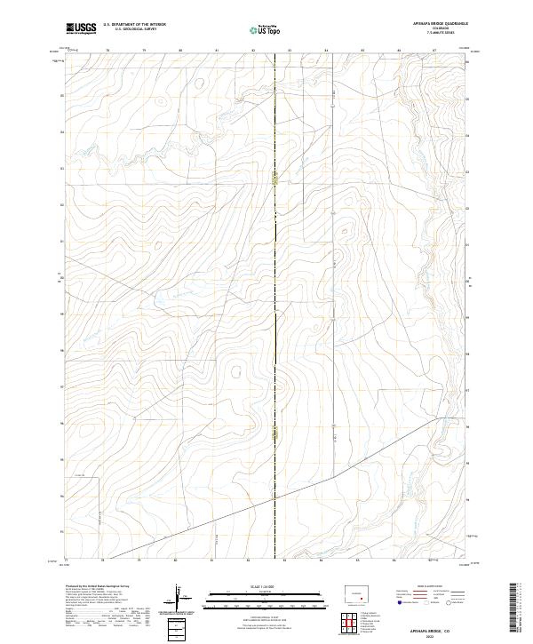
2022 Map of Apishapa Bridge
USGS Topo · Published 2022About this map
The Apishapa River cuts through this high plains landscape on the border of Pueblo and Otero counties. This area is defined by a network of drainage systems including Mustang Cr, Powell Arroyo, and Saunders Arroyo, which illustrate the complex local hydrology feeding into the larger river basin. The map reveals a remote ranching or agricultural environment where infrastructure is limited to essential county routes like Whiterock Rd and Co Rd 2. The straight-line boundaries of the Public Land Survey System, including t23s r60w and t24s r59w, dictate the land's organization, creating a stark geometric contrast with the wandering paths of the natural waterways.
Find a feature on this map
15 named features on this map. Tap any name to fly to it.
Don’t see what you’re looking for? This feature index may not catch every label — zoom into the map to look around manually.
Map Details
Editions of this 2022 Apishapa Bridge Map
This is the sole edition of this map. No revisions or reprints were ever made.
Other maps of this area

1891 · Catlin
USGS Topo · 1:125,000

1891 · Timpas
USGS Topo · 1:125,000

1891 · Nepesta
USGS Topo · 1:125,000

1891 · Apishapa
USGS Topo · 1:125,000

1893 · Nepesta
USGS Topo · 1:125,000

1893 · Apishapa
USGS Topo · 1:125,000

1893 · Catlin
USGS Topo · 1:125,000

1894 · Timpas
USGS Topo · 1:125,000

1897 · Apishapa
USGS Topo · 1:125,000

1904 · Nepesta
USGS Topo · 1:125,000