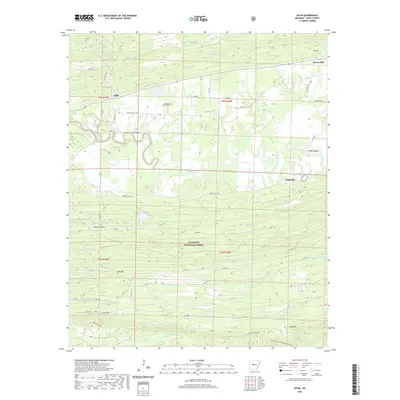
2020 Map of Aplin
USGS Topo · Published 2020About this map
The Fourche LaFave River meanders through this Perry County landscape, defining the topography between the small settlements of Aplin and Ragsdale. To the south, the terrain rises significantly as the map enters the Ouachita National Forest, where a series of ridges including Link Mtn and Cedar Mtn dominate the horizon. This rugged southern portion is also home to the headwaters of the Maumelle River and the Ouachita National Recreation Trail, which traverses the southern border near Long Mtn.
Find a feature on this map
54 named features on this map. Tap any name to fly to it.
Don’t see what you’re looking for? This feature index may not catch every label — zoom into the map to look around manually.
Map Details
Editions of this 2020 Aplin Map
This is the sole edition of this map. No revisions or reprints were ever made.
Other maps of this area

1888 · Dardanelle #4
USGS Topo · 1:62,500

1889 · Morrilton No. 3
USGS Topo · 1:62,500

1890 · Benton
USGS Topo · 1:125,000

1890 · Hot Springs
USGS Topo · 1:125,000

1890 · Dardanelle
USGS Topo · 1:125,000

1892 · Morrillton
USGS Topo · 1:125,000

1894 · Morrillton
USGS Topo · 1:125,000

1894 · Hot Springs
USGS Topo · 1:125,000

1894 · Benton
USGS Topo · 1:125,000

1955 · Little Rock
USGS Topo · 1:250,000