2024 Map of Aplin
USGS Topo · Published 2024About this map
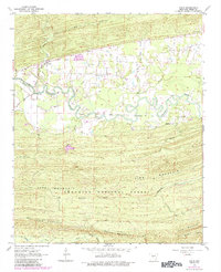
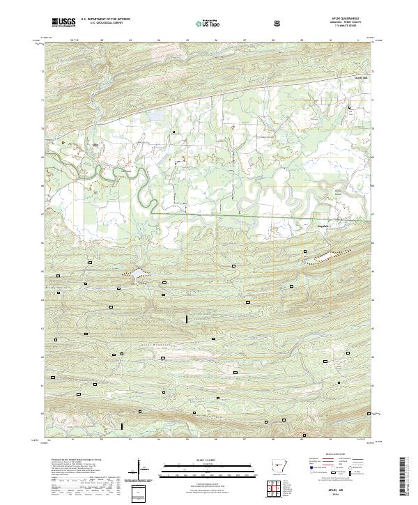
The Fourche La Fave River snakes across the northern portion of this Perry County landscape, defining the topography near settlements like Aplin and Cherry Hill. This area is characterized by a transition from river lowlands to the high ridges of the Ouachita National Forest. To the south, the terrain rises sharply into the mountains, where Link Mountain and Cedar Mountain overlook the protected Flatside Wilderness. This wilderness area contains the headwaters of the Maumelle River and Crystal Prong, marking a significant hydrologic divide.
Find a feature on this map
54 named features on this map. Tap any name to fly to it.
Don’t see what you’re looking for? This feature index may not catch every label — zoom into the map to look around manually.
Map Details
Editions of this 2024 Aplin Map
This is the sole edition of this map. No revisions or reprints were ever made.