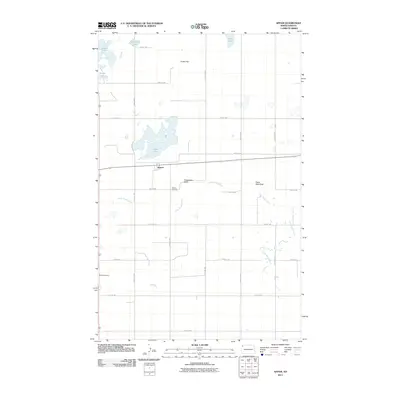
2011 Map of Appam
USGS Topo · Published 2011About this map
The settlement of Appam serves as the central point in this northern Williams County landscape, characterized by a complex network of glacial lakes and prairie waterways. Water is a defining element here, with the sprawling, irregularly shaped Alkali Lake dominating the central terrain, while Green Lake, Knudsvig Lake, and Kettle Lake dot the northwestern corner. The Little Muddy River meanders through the southern half of the quadrangle, creating distinctive landmarks such as Horseshoe Bend as it flows eastward. For those researching local heritage, the map identifies the locations of Bethany Cemetery near the townsite and Bethel Cemetery to the southwest. The landscape is also marked by prominent natural features like Indian Hill and Eagle Nest Rock, set against a rigid grid of rural roads including County HWY 9 and numerous numerical avenues and streets.
Find a feature on this map
27 named features on this map. Tap any name to fly to it.
Don’t see what you’re looking for? This feature index may not catch every label — zoom into the map to look around manually.
Map Details
Editions of this 2011 Appam Map
This is the sole edition of this map. No revisions or reprints were ever made.
Other maps of this area

1911 · Ray
USGS Topo · 1:125,000

1948 · Smoky Butte
USGS Topo · 1:24,000

1948 · Stady
USGS Topo · 1:24,000

1948 · Bright Water Lake
USGS Topo · 1:24,000

1948 · Zahl
USGS Topo · 1:24,000

1953 · Williston
USGS Topo · 1:250,000

1957 · Williston
USGS Topo · 1:250,000

1974 · Blacktail Lake
USGS Topo · 1:24,000

1974 · Twin Lakes
USGS Topo · 1:24,000

1977 · Appam
USGS Topo · 1:24,000