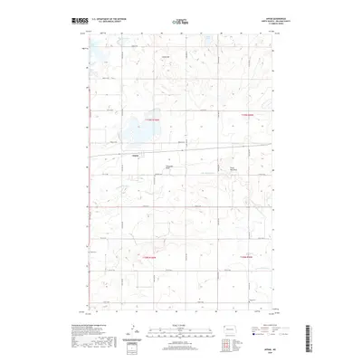
2020 Map of Appam
USGS Topo · Published 2020About this map
Appam serves as the central settlement in this portion of Williams County, situated within a landscape shaped by the Little Muddy River and its varied drainage patterns. The township structure is clearly defined by a grid of rural roads, including 78th St NW and 81st St NW, which connect isolated homesteads and local landmarks. To the north, a cluster of glacial water bodies like Green Lake, Knudsvig Lake, and Kettle Lake dot the terrain near Indian Hill. Genealogy and local history are anchored by several established burial grounds, notably Bethany Cem near the river's Horseshoe Bend, as well as Bethel Cem and Hauge Cem in the southern sections. This modern survey illustrates the enduring agricultural character of the region, where land use remains closely tied to the natural features of the prairie.
Find a feature on this map
25 named features on this map. Tap any name to fly to it.
Don’t see what you’re looking for? This feature index may not catch every label — zoom into the map to look around manually.
Map Details
Editions of this 2020 Appam Map
This is the sole edition of this map. No revisions or reprints were ever made.
Other maps of this area

1911 · Ray
USGS Topo · 1:125,000

1948 · Smoky Butte
USGS Topo · 1:24,000

1948 · Stady
USGS Topo · 1:24,000

1948 · Bright Water Lake
USGS Topo · 1:24,000

1948 · Zahl
USGS Topo · 1:24,000

1953 · Williston
USGS Topo · 1:250,000

1957 · Williston
USGS Topo · 1:250,000

1974 · Blacktail Lake
USGS Topo · 1:24,000

1974 · Twin Lakes
USGS Topo · 1:24,000

1977 · Appam
USGS Topo · 1:24,000