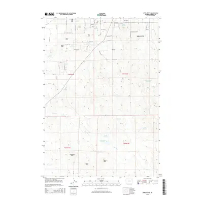
2015 Map of Appel Butte
USGS Topo · Published 2015About this map
Gillette's western fringe reveals a landscape defined by an extensive network of small-scale water management and distinctive high-plains topography. The terrain is marked by numerous ephemeral drainages and coulees, such as Janice Draw and Little Draw, which have been strategically dammed to create a series of named catchments including Little Reservoir, Knob Reservoir, and Rocky Reservoir. These water sources are essential to the agricultural and ranching operations that characterize the region surrounding the city.
Find a feature on this map
70 named features on this map. Tap any name to fly to it.
Don’t see what you’re looking for? This feature index may not catch every label — zoom into the map to look around manually.
Map Details
Editions of this 2015 Appel Butte Map
This is the sole edition of this map. No revisions or reprints were ever made.
Other maps of this area

1954 · Gillette
USGS Topo · 1:250,000

1955 · Gillette
USGS Topo · 1:250,000

1958 · Gillette
USGS Topo · 1:250,000

1962 · Gillette
USGS Topo · 1:250,000

1971 · Scaper Reservoir
USGS Topo · 1:24,000

1971 · The Gap SW
USGS Topo · 1:24,000

1971 · Gillette East
USGS Topo · 1:24,000

1971 · Oriva
USGS Topo · 1:24,000
1971 · Pleasantdale
USGS Topo · 1:24,000
1971 · The Gap
USGS Topo · 1:24,000