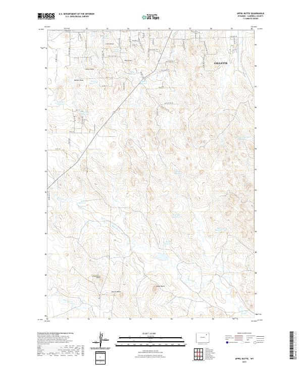
2021 Map of Appel Butte
USGS Topo · Published 2021About this map
Gillette occupies the northeastern corner of this Campbell County terrain, where residential expansion meets a landscape defined by localized water management and high plains relief. Named buttes such as Appel Butte, Sassick Butte, and Schoolhouse Butte rise above a drainage network dominated by Bone Pile Cr and Bluegate Cr. The distribution of dozens of small impoundments, including Janice Reservoir, Channey Reservoir, and Margaret Sarah Reservoir, indicates the vital importance of water storage for ranching and development in this arid environment.
Find a feature on this map
69 named features on this map. Tap any name to fly to it.
Don’t see what you’re looking for? This feature index may not catch every label — zoom into the map to look around manually.
Map Details
Editions of this 2021 Appel Butte Map
This is the sole edition of this map. No revisions or reprints were ever made.
Other maps of this area

1954 · Gillette
USGS Topo · 1:250,000

1955 · Gillette
USGS Topo · 1:250,000

1958 · Gillette
USGS Topo · 1:250,000

1962 · Gillette
USGS Topo · 1:250,000

1971 · Scaper Reservoir
USGS Topo · 1:24,000

1971 · The Gap SW
USGS Topo · 1:24,000

1971 · Gillette East
USGS Topo · 1:24,000

1971 · Oriva
USGS Topo · 1:24,000
1971 · Pleasantdale
USGS Topo · 1:24,000
1971 · The Gap
USGS Topo · 1:24,000