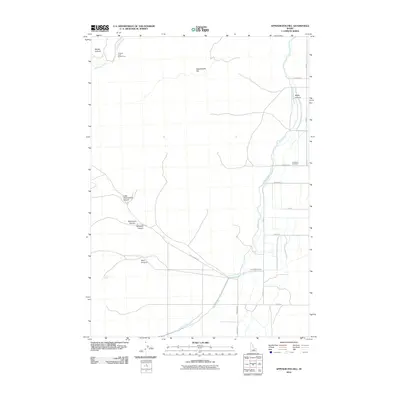
2010 Map of Appendicitis Hill
USGS Topo · Published 2010About this map
Appendicitis Hill rises above a high-desert landscape defined by complex water management and deep canyon systems in this 2010 USGS survey. The Eastern Snake River Plain's agricultural history is visible through the extensive network of the Blaine Canal and Lower Blaine Canal, which distribute water across a grid of rural roads like Aikele Rd and Jensen Ln. To the west, the terrain transitions into a series of drainages, including Marsh Canyon, Hammond Canyon, and Little Chokecherry Canyon, reflecting the area's geological character. For local historians, the Lost River Cemetery provides a specific point of genealogical interest, while the Antelope Creek Access Area and Sorenson Spring indicate the enduring importance of natural water sources in this arid Idaho environment.
Find a feature on this map
20 named features on this map. Tap any name to fly to it.
Don’t see what you’re looking for? This feature index may not catch every label — zoom into the map to look around manually.
Map Details
Editions of this 2010 Appendicitis Hill Map
This is the sole edition of this map. No revisions or reprints were ever made.
Other maps of this area

1935 · MacKay
USGS Topo · 1:96,000

1940 · Mackay
USGS Topo · 1:62,500

1955 · Idaho Falls
USGS Topo · 1:250,000

1958 · Idaho Falls
USGS Topo · 1:250,000

1960 · Grouse
USGS Topo · 1:62,500

1960 · Mackay
USGS Topo · 1:62,500

1969 · Darlington
USGS Topo · 1:24,000

1969 · Ramshorn Canyon
USGS Topo · 1:24,000

1972 · Arco North
USGS Topo · 1:24,000

1972 · Arco South
USGS Topo · 1:24,000