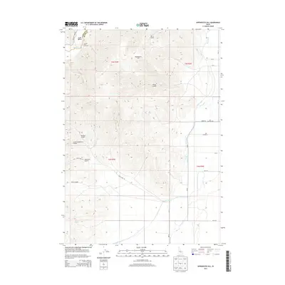
2013 Map of Appendicitis Hill
USGS Topo · Published 2013About this map
Lost River flows through the high desert landscape of Custer County and Butte County in this 2013 survey. The prominent Appendicitis Hill rises above a series of deep drainages, including Berry Canyon, Rocky Canyon, and Newman Canyon. The map reveals a highly managed agricultural system at the base of these mountains, defined by the Moore Canal, Blaine Canal, and Lower Blaine Canal. This irrigation network supports the valley floor near the Lost River Cemetery, illustrating the essential connection between water management and settlement in this arid Idaho corridor. Recreational and natural landmarks such as the Antelope Creek Access Area and the isolated Sorenson Spring provide further points of interest for those tracing the local geography or family ties to the Antelope Creek drainage.
Find a feature on this map
26 named features on this map. Tap any name to fly to it.
Don’t see what you’re looking for? This feature index may not catch every label — zoom into the map to look around manually.
Map Details
Editions of this 2013 Appendicitis Hill Map
This is the sole edition of this map. No revisions or reprints were ever made.
Other maps of this area

1935 · MacKay
USGS Topo · 1:96,000

1940 · Mackay
USGS Topo · 1:62,500

1955 · Idaho Falls
USGS Topo · 1:250,000

1958 · Idaho Falls
USGS Topo · 1:250,000

1960 · Grouse
USGS Topo · 1:62,500

1960 · Mackay
USGS Topo · 1:62,500

1969 · Darlington
USGS Topo · 1:24,000

1969 · Ramshorn Canyon
USGS Topo · 1:24,000

1972 · Arco North
USGS Topo · 1:24,000

1972 · Arco South
USGS Topo · 1:24,000