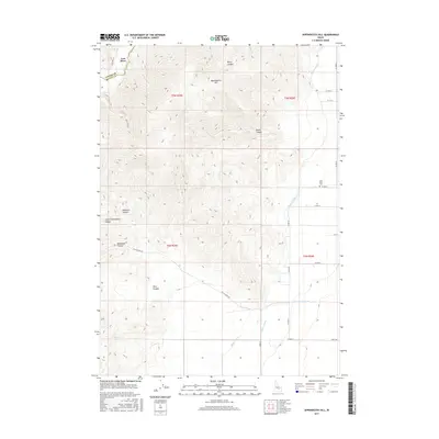
2017 Map of Appendicitis Hill
USGS Topo · Published 2017About this map
The high desert terrain of the Custer and Butte county border is anchored by Appendicitis Hill, a prominent rise surrounded by an intricate system of drainages and irrigation infrastructure. The northern edge of the map features the settlement of Lost River, located near the namesake Lost River Cem. This area illustrates the transition from the high, arid peaks of Beck Canyon and Newman Canyon to the managed agricultural lands of the valley floor. Water management is a central theme of this landscape, with the Blaine Canal, Lower Blaine Canal, and Moore Canal drawing from regional sources to support local ranching and farming. Key landmarks like Sorenson Spring and the winding Doyle Creek Rd provide essential points of orientation for those tracing the development of this rural Idaho interior.
Find a feature on this map
27 named features on this map. Tap any name to fly to it.
Don’t see what you’re looking for? This feature index may not catch every label — zoom into the map to look around manually.
Map Details
Editions of this 2017 Appendicitis Hill Map
This is the sole edition of this map. No revisions or reprints were ever made.
Other maps of this area

1935 · MacKay
USGS Topo · 1:96,000

1940 · Mackay
USGS Topo · 1:62,500

1955 · Idaho Falls
USGS Topo · 1:250,000

1958 · Idaho Falls
USGS Topo · 1:250,000

1960 · Grouse
USGS Topo · 1:62,500

1960 · Mackay
USGS Topo · 1:62,500

1969 · Darlington
USGS Topo · 1:24,000

1969 · Ramshorn Canyon
USGS Topo · 1:24,000

1972 · Arco North
USGS Topo · 1:24,000

1972 · Arco South
USGS Topo · 1:24,000