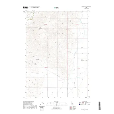
2020 Map of Appendicitis Hill
USGS Topo · Published 2020About this map
Appendicitis Hill dominates this high-altitude landscape where the mountains descend into the Big Lost River Valley. This 2020 survey details a complex network of water management essential to the region's agricultural viability, featuring the Blaine Canal, Moore Canal, and Lower Blaine Canal winding through the lowlands. Near the northern boundary between Custer and Butte counties, the terrain is marked by deep drainage systems including Newman Canyon, Hammond Canyon, and Little Chokecherry Canyon. For those tracing local history or genealogy, the Lost River Cem is a primary landmark situated near the banks of the Lost River. The map also captures the path of Doyle Creek Rd as it cuts across the southern foothills, providing access to secluded points like Sorenson Spring.
Find a feature on this map
22 named features on this map. Tap any name to fly to it.
Don’t see what you’re looking for? This feature index may not catch every label — zoom into the map to look around manually.
Map Details
Editions of this 2020 Appendicitis Hill Map
This is the sole edition of this map. No revisions or reprints were ever made.
Other maps of this area

1935 · MacKay
USGS Topo · 1:96,000

1940 · Mackay
USGS Topo · 1:62,500

1955 · Idaho Falls
USGS Topo · 1:250,000

1958 · Idaho Falls
USGS Topo · 1:250,000

1960 · Grouse
USGS Topo · 1:62,500

1960 · Mackay
USGS Topo · 1:62,500

1969 · Darlington
USGS Topo · 1:24,000

1969 · Ramshorn Canyon
USGS Topo · 1:24,000

1972 · Arco North
USGS Topo · 1:24,000

1972 · Arco South
USGS Topo · 1:24,000