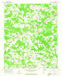
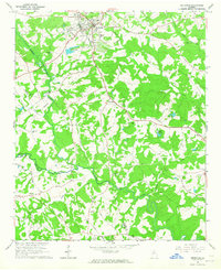
1964 Map of Apple Valley
USGS Topo · Published 1965About this map
The North Oconee River and its numerous tributaries, such as Parks Creek, define the landscape of Jackson County in the mid-1960s. This survey illustrates a rural Georgia region transitioning between traditional agriculture and modern infrastructure, evidenced by the presence of a County Airport and a nearby Drag Strip in the center of the sheet. The settlement pattern is anchored by Jefferson in the south and Maysville in the north, connected by a network of rural roads and the Seaboard Air Line railroad.
Find a feature on this map
34 named features on this map. Tap any name to fly to it.
Don’t see what you’re looking for? This feature index may not catch every label — zoom into the map to look around manually.
Map Details
Editions of this 1964 Apple Valley Map
2 editions found
Other maps of this area

1891 · Gainesville
USGS Topo · 1:125,000

1891 · Carnesville
USGS Topo · 1:125,000

1954 · Greenville
USGS Topo · 1:250,000

1958 · Greenville
USGS Topo · 1:250,000

1964 · Commerce
USGS Topo · 1:24,000

1964 · Maysville
USGS Topo · 1:24,000
1964 · Winder North
USGS Topo · 1:24,000
1964 · Nicholson
USGS Topo · 1:24,000

1964 · Pendergrass
USGS Topo · 1:24,000
1964 · Jefferson
USGS Topo · 1:24,000