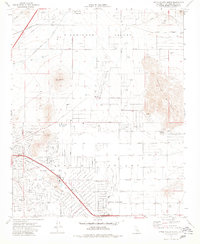
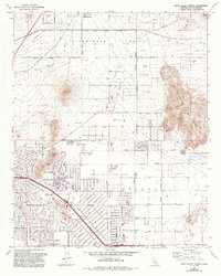
1970 Map of Apple Valley North
USGS Topo · Published 1980About this map
Apple Valley expands northward across the high desert in this 1970 snapshot, showing a transition from the structured residential grid of the town to the open expanse of Sidewinder Valley. The map highlights the early development of local community landmarks such as Rancho Verde Sch and Yucca Loma Sch, alongside leisure destinations like the Apple Valley Country Club. To the north, the terrain is dominated by prominent elevations including Bell Mountain and the western slopes of Fairview Mountain, where various mines and prospects suggest the area's mineral interest. The presence of the Radio Tower (KAVR) and the Apple Valley Airport Road corridor illustrates the growing infrastructure of the era, while the numerous labels for a Dry Well and Well emphasize the critical nature of water management in this arid San Bernardino County landscape.
Find a feature on this map
58 named features on this map. Tap any name to fly to it.
Don’t see what you’re looking for? This feature index may not catch every label — zoom into the map to look around manually.
Map Details
Editions of this 1970 Apple Valley North Map
5 editions found
Other maps of this area

1901 · Southern California Sheet No. 1
USGS Topo · 1:250,000

1902 · Deep Creek
USGS Topo · 1:62,500

1902 · Hesperia
USGS Topo · 1:62,500

1904 · Southern California Sheet No. 1
USGS Topo · 1:250,000

1932 · Barstow
USGS Topo · 1:125,000

1934 · Barstow
USGS Topo · 1:125,000

1942 · Hesperia
USGS Topo · 1:62,500

1953 · San Bernardino
USGS Topo · 1:250,000

1956 · San Bernardino
USGS Topo · 1:250,000
1956 · Hesperia
USGS Topo · 1:24,000
Featured Places
- Apple Valley, CA
- Desert Knolls Manor, Apple Valley
- Bell Mountain, Apple Valley
- San Bernardino County, CA
- United States