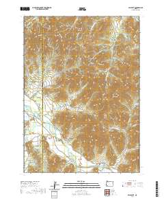
2020 Map of Applegate
USGS Topo · Published 2020About this map
Provolt and Applegate serve as the primary anchors for this region where the Josephine Co Jackson Co line divides a landscape of deep gulches and high ridges. The Applegate River winds through the lower elevations, flanked by agricultural and water management features like the New Berryman Ditch, Stone Sumps, and the Cook Reservoir. The terrain is characterized by numerous named drainages such as Myrtle Gulch, Whisky Gulch, and Johnsons Gulch, many of which likely speak to the early prospecting and homesteading history of the area.
Find a feature on this map
71 named features on this map. Tap any name to fly to it.
Don’t see what you’re looking for? This feature index may not catch every label — zoom into the map to look around manually.
Map Details
Editions of this 2020 Applegate Map
This is the sole edition of this map. No revisions or reprints were ever made.
Other maps of this area

1908 · Grants Pass
USGS Topo · 1:125,000

1954 · Oregon Caves
USGS Topo · 1:62,500

1954 · Gold Hill
USGS Topo · 1:62,500

1954 · Grants Pass
USGS Topo · 1:62,500

1954 · Ruch
USGS Topo · 1:62,500

1955 · Medford
USGS Topo · 1:250,000

1957 · Medford
USGS Topo · 1:250,000

1958 · Medford
USGS Topo · 1:250,000
1974 · Grants Pass NE
USGS Topo · 1:24,000
1983 · Mt. Isabelle
USGS Topo · 1:24,000