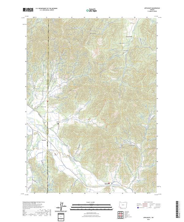
2024 Map of Applegate
USGS Topo · Published 2024About this map
Missouri Flat and the surrounding river bottomlands define the western edge of this landscape along the Josephine and Jackson county line. The Applegate River winds through the southern reaches of the quadrangle, supporting the historic settlements of Applegate and Provolt. Genealogical researchers will find the Missouri Flat Cem near the junction of Kubli Rd and Northside Rd, a significant landmark for tracing early families in the valley. The terrain transitions from these alluvial flats into a dense network of gulches and peaks, including Billy Mtn and Old Blue Mtn. Numerous watercourses such as Savage Creek, Foots Creek, and Slagle Creek drain the surrounding heights, while family-named landmarks like Gillet Gulch and Taylor Gulch point to the area’s deep-rooted land use history.
Find a feature on this map
68 named features on this map. Tap any name to fly to it.
Don’t see what you’re looking for? This feature index may not catch every label — zoom into the map to look around manually.
Map Details
Editions of this 2024 Applegate Map
This is the sole edition of this map. No revisions or reprints were ever made.
Other maps of this area

1908 · Grants Pass
USGS Topo · 1:125,000

1954 · Oregon Caves
USGS Topo · 1:62,500

1954 · Gold Hill
USGS Topo · 1:62,500

1954 · Grants Pass
USGS Topo · 1:62,500

1954 · Ruch
USGS Topo · 1:62,500

1955 · Medford
USGS Topo · 1:250,000

1957 · Medford
USGS Topo · 1:250,000

1958 · Medford
USGS Topo · 1:250,000
1974 · Grants Pass NE
USGS Topo · 1:24,000
1983 · Mt. Isabelle
USGS Topo · 1:24,000