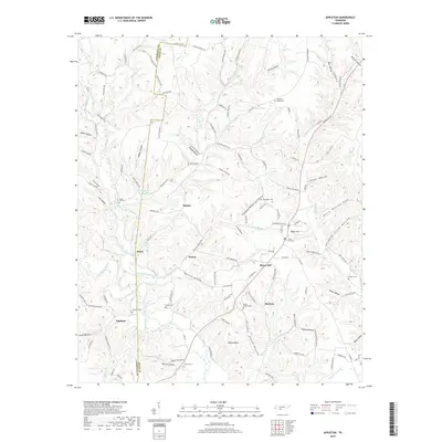
2019 Map of Appleton
USGS Topo · Published 2019About this map
Minor Hill and Appleton anchor this southern Tennessee landscape along the Lawrence and Giles county line. The terrain is defined by an intricate network of narrow hollows and ridge-top settlements, with the White Ridge rising between the drainages of Sugar Creek and the W Fork Shoal Cr. For family historians, the sheet is particularly dense with small community landmarks, including the Booth Chapel Cem, Oxford Cem, and Dobbins Cem, which sit near old intersections in settlements like Marbuts and Sexton. The map preserves the names of numerous natural springs, such as Poplar Spring and Flippo Spring, which were once vital water sources for these upland farmsteads. This 2019 survey documents the enduring rural structure of the region, where legacy road names like Long Branch Rd and Sutton Hollow Rd trace the paths of early settlers through the deep valleys.
Find a feature on this map
141 named features on this map. Tap any name to fly to it.
Don’t see what you’re looking for? This feature index may not catch every label — zoom into the map to look around manually.
Map Details
Editions of this 2019 Appleton Map
This is the sole edition of this map. No revisions or reprints were ever made.
Other maps of this area

1914 · Rogersville
USGS Topo · 1:48,000

1916 · Rogersville
USGS Topo · 1:62,500

1936 · Union Hill
USGS Topo · 1:24,000

1936 · Aspen Hill
USGS Topo · 1:24,000

1936 · Lexington
USGS Topo · 1:24,000

1936 · Lawrenceburg
USGS Topo · 1:24,000

1936 · Pulaski
USGS Topo · 1:24,000

1936 · Bodenham
USGS Topo · 1:24,000

1936 · Appleton
USGS Topo · 1:24,000

1936 · Bonnertown
USGS Topo · 1:24,000