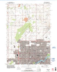
1992 Map of Appleton
USGS Topo · Published 1996About this map
Appleton expands northward from the banks of the Fox River in this detailed look at Outagamie County's developing urban fringe. The city's growth is anchored by institutions like Lawrence College and punctuated by established resting places including Riverside Cem and St Joseph Cem. To the west, the emergence of a major commercial hub is signaled by the Fox River Mall, marking a shift in land use from the agricultural character found further north in Center and Grand Chute.
Find a feature on this map
38 named features on this map. Tap any name to fly to it.
Don’t see what you’re looking for? This feature index may not catch every label — zoom into the map to look around manually.
Map Details
Editions of this 1992 Appleton Map
This is the sole edition of this map. No revisions or reprints were ever made.
Other maps of this area

1911 · Neenah
USGS Topo · 1:62,500

1955 · Neenah
USGS Topo · 1:62,500

1955 · Appleton
USGS Topo · 1:24,000

1955 · Appleton
USGS Topo · 1:62,500

1955 · Neenah
USGS Topo · 1:24,000

1955 · Green Bay
USGS Topo · 1:250,000

1956 · New London
USGS Topo · 1:48,000

1961 · Oshkosh
USGS Topo · 1:62,500

1961 · Oshkosh NE
USGS Topo · 1:24,000
1969 · Greenville
USGS Topo · 1:24,000