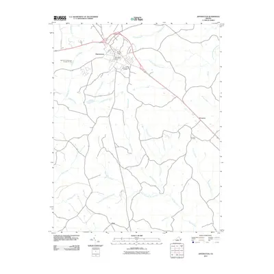
2010 Map of Appomattox
USGS Topo · Published 2010About this map
Appomattox serves as the primary hub of this region, situated at the headwaters of several critical drainage systems including the Falling River and the South Fork Appomattox River. The town is well-documented with the Appomattox Post Office and the expansive Appomattox Cemetery, reflecting its role as a local center of commerce and community memory. To the southeast, the smaller settlement of Evergreen sits near its own namesake Evergreen Cemetery, while the locality of Chap anchors the southern reaches of the quadrangle.
Find a feature on this map
24 named features on this map. Tap any name to fly to it.
Don’t see what you’re looking for? This feature index may not catch every label — zoom into the map to look around manually.
Map Details
Editions of this 2010 Appomattox Map
This is the sole edition of this map. No revisions or reprints were ever made.
Other maps of this area

1892 · Appomattox
USGS Topo · 1:125,000

1947 · Roanoke
USGS Topo · 1:250,000

1956 · Brookneal
USGS Topo · 1:62,500

1956 · Charlotte Court House
USGS Topo · 1:62,500

1958 · Appomattox
USGS Topo · 1:62,500

1958 · Pamplin City
USGS Topo · 1:62,500

1959 · Roanoke
USGS Topo · 1:250,000

1963 · Roanoke
USGS Topo · 1:250,000
1966 · Mike
USGS Topo · 1:24,000
1968 · Red House
USGS Topo · 1:24,000