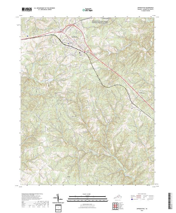
2022 Map of Appomattox
USGS Topo · Published 2022About this map
Appomattox Court House National Historical Park anchors the northern landscape of this Virginia survey, preserving the grounds where the Civil War drew toward its conclusion. The modern town of Appomattox sits just south of the park, defined by its civic center at the Appomattox County Courthouse and a transportation corridor that includes Confederate Blvd and the historic Old Courthouse Rd. The terrain is deeply etched by a dense network of watercourses, including the South Fork Appomattox River and Falling River, which create a complex system of ridges and hollows that historically dictated settlement patterns. To the east and south, the smaller communities of Evergreen and Chap appear alongside local landmarks such as Liberty Church Cem and Evergreen Cem, offering clear documentation of family burial sites and rural church locations for those tracing local genealogy.
Find a feature on this map
125 named features on this map. Tap any name to fly to it.
Don’t see what you’re looking for? This feature index may not catch every label — zoom into the map to look around manually.
Map Details
Editions of this 2022 Appomattox Map
This is the sole edition of this map. No revisions or reprints were ever made.
Other maps of this area

1892 · Appomattox
USGS Topo · 1:125,000

1947 · Roanoke
USGS Topo · 1:250,000

1956 · Brookneal
USGS Topo · 1:62,500

1956 · Charlotte Court House
USGS Topo · 1:62,500

1958 · Appomattox
USGS Topo · 1:62,500

1958 · Pamplin City
USGS Topo · 1:62,500

1959 · Roanoke
USGS Topo · 1:250,000

1963 · Roanoke
USGS Topo · 1:250,000
1966 · Mike
USGS Topo · 1:24,000
1968 · Red House
USGS Topo · 1:24,000