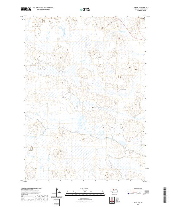
2021 Map of Arabia NW
USGS Topo · Published 2021About this map
Swan Lake sits amidst the characteristic wetland-dotted landscape of Cherry County in this recent survey. The area is defined by its complex hydrology, where Evergreen Cr and Fairfield Cr meander through a landscape marked by the Ainsworth Canal. This hydraulic infrastructure reflects the region's managed water resources, essential for supporting the cattle country's vast grasslands. In the northeastern corner, the Cowboy Trl cuts across the terrain, repurposing a former railroad corridor for modern recreational use. This mapping effort provides an exact look at the contemporary boundary lines of townships t32n r27w and t31n r26w, where the lack of dense settlement emphasizes the open, agricultural character of the Nebraska Sandhills.
Find a feature on this map
9 named features on this map. Tap any name to fly to it.
Don’t see what you’re looking for? This feature index may not catch every label — zoom into the map to look around manually.
Map Details
Editions of this 2021 Arabia NW Map
This is the sole edition of this map. No revisions or reprints were ever made.
Other maps of this area

1950 · Sparks
USGS Topo · 1:62,500

1950 · Simeon
USGS Topo · 1:62,500

1950 · Arabia
USGS Topo · 1:62,500

1950 · Valentine
USGS Topo · 1:62,500

1957 · Valentine
USGS Topo · 1:250,000

1959 · Valentine
USGS Topo · 1:250,000

1983 · Valentine South
USGS Topo · 1:24,000
1983 · Thatcher
USGS Topo · 1:24,000
1983 · Sparks SE
USGS Topo · 1:24,000
1985 · Arabia SE
USGS Topo · 1:24,000