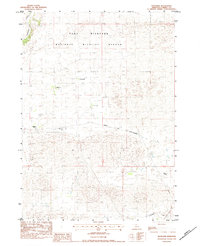
1983 Map of Thatcher
USGS Topo · Published 1984About this map
The Fort Niobrara National Wildlife Refuge dominates the northern reaches of this Cherry County landscape, where the Niobrara River carves through the sandhills of northern Nebraska. By the early 1980s, the area remained defined by a scattered network of prominent family holdings, including the Paxson Ranch, Taylor Ranch, and Swanson Ranch. These ranching operations and the small settlement at Thatcher were linked by the tracks of the Chicago and North Western railroad, which bisects the quadrangle from east to west.
Find a feature on this map
11 named features on this map. Tap any name to fly to it.
Don’t see what you’re looking for? This feature index may not catch every label — zoom into the map to look around manually.
Map Details
Editions of this 1983 Thatcher Map
This is the sole edition of this map. No revisions or reprints were ever made.
Other maps of this area

1950 · Sparks
USGS Topo · 1:62,500

1950 · Simeon
USGS Topo · 1:62,500

1950 · Arabia
USGS Topo · 1:62,500

1950 · Valentine
USGS Topo · 1:62,500

1957 · Valentine
USGS Topo · 1:250,000

1959 · Valentine
USGS Topo · 1:250,000
1983 · Sparks
USGS Topo · 1:24,000
1983 · Valentine North
USGS Topo · 1:24,000

1983 · Valentine South
USGS Topo · 1:24,000
1983 · Sparks SE
USGS Topo · 1:24,000