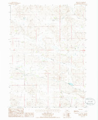
1985 Map of Arabia NW
USGS Topo · Published 1985About this map
Fairfield stands at the heart of this mid-1980s landscape in Cherry County, where the Sandhills terrain is defined by its drainage patterns and water management systems. The most prominent human intervention in this rural expanse is the Ainsworth Canal, which traverses the southern portion of the sheet. This engineering work, designed to bring water to the semi-arid region, represents the agricultural development and water rights history of central Nebraska. To the north, the natural path of Evergreen Creek meanders through the sandy hills, providing a sharp contrast between the linear precision of modern irrigation and the ancient, winding waterways of the Plains. This provisional survey captures the intersection of ranching life and large-scale water infrastructure in a period when the Nebraska Sandhills remained sparsely populated but technologically integrated.
Find a feature on this map
5 named features on this map. Tap any name to fly to it.
Don’t see what you’re looking for? This feature index may not catch every label — zoom into the map to look around manually.
Map Details
Editions of this 1985 Arabia NW Map
This is the sole edition of this map. No revisions or reprints were ever made.
Other maps of this area

1950 · Sparks
USGS Topo · 1:62,500

1950 · Simeon
USGS Topo · 1:62,500

1950 · Arabia
USGS Topo · 1:62,500

1950 · Valentine
USGS Topo · 1:62,500

1957 · Valentine
USGS Topo · 1:250,000

1959 · Valentine
USGS Topo · 1:250,000

1983 · Valentine South
USGS Topo · 1:24,000
1983 · Thatcher
USGS Topo · 1:24,000
1983 · Sparks SE
USGS Topo · 1:24,000
1985 · Arabia SE
USGS Topo · 1:24,000