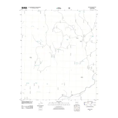
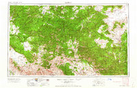
2011 Map of Aragon
USGS Topo · Published 2011About this map
Aragon sits at the southern edge of this high-altitude landscape, where the Tularosa River winds through the valley floor. The settlement serves as a focal point for a region defined by complex drainage patterns and livestock infrastructure, evidenced by numerous water features like New Red Steer Tank and Spring Tank. The terrain rises sharply to the heights of Apache Mountain and Tularosa Mountain, separated by deep cuts such as Negro Canyon and Bull Camp Canyon. This 2011 survey documents a network of Forest Service roads, including Forest Road 17, that connect remote springs like Negrito Springs and Willow Bush Spring. The inclusion of the Sand Flat Airstrip highlights the logistical requirements of managing this expansive terrain, while the naming of small features like Whiskey Creek and Mata Spring provides essential landmarks for local navigation and land management.
Find a feature on this map
37 named features on this map. Tap any name to fly to it.
Don’t see what you’re looking for? This feature index may not catch every label — zoom into the map to look around manually.
Map Details
Editions of this 2011 Aragon Map
This is the sole edition of this map. No revisions or reprints were ever made.
Other maps of this area
1915 · Reserve
USGS Topo · 1:125,000
1918 · Pelona
USGS Topo · 1:125,000
1918 · Reserve
USGS Topo · 1:125,000

1954 · Clifton
USGS Topo · 1:250,000

1954 · Saint Johns
USGS Topo · 1:250,000

1957 · Clifton
USGS Topo · 1:250,000

1957 · Saint Johns
USGS Topo · 1:250,000

1958 · Clifton
USGS Topo · 1:250,000

1958 · Saint Johns
USGS Topo · 1:250,000
1962 · Clifton
USGS Topo · 1:250,000