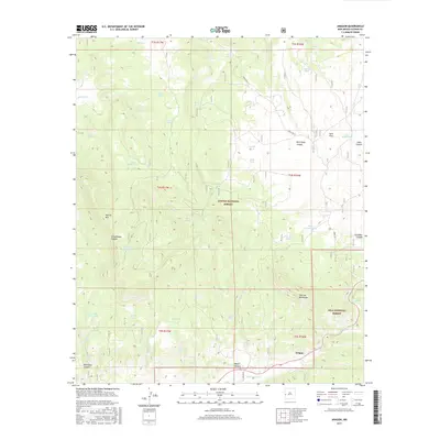
2017 Map of Aragon
USGS Topo · Published 2017About this map
Aragon sits at the junction of high-altitude drainages and State Hwy 12, serving as a primary point of human presence in this high-desert landscape. The terrain is defined by the transition between the Apache National Forest and the Gila National Forest, where steep relief is marked by landmarks like Apache Mtn and the Tularosa Mountains. This area relies heavily on a complex network of springs and tanks for water management, reflecting the importance of every drainage for survival and land use.
Find a feature on this map
51 named features on this map. Tap any name to fly to it.
Don’t see what you’re looking for? This feature index may not catch every label — zoom into the map to look around manually.
Map Details
Editions of this 2017 Aragon Map
This is the sole edition of this map. No revisions or reprints were ever made.
Other maps of this area

1915 · Reserve
USGS Topo · 1:125,000

1918 · Pelona
USGS Topo · 1:125,000

1918 · Reserve
USGS Topo · 1:125,000

1954 · Clifton
USGS Topo · 1:250,000

1954 · Saint Johns
USGS Topo · 1:250,000

1957 · Clifton
USGS Topo · 1:250,000

1957 · Saint Johns
USGS Topo · 1:250,000

1958 · Clifton
USGS Topo · 1:250,000

1958 · Saint Johns
USGS Topo · 1:250,000

1962 · Clifton
USGS Topo · 1:250,000