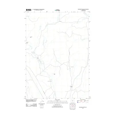
2012 Map of Arapahoe Butte
USGS Topo · Published 2012About this map
The high desert landscape of Fremont County is defined here by sparse ranching outposts and a complex drainage system tributary to the Big Horn Basin. Cattle ranching operations including Reck Ranch, Mack Ranch, and the Bow and Arrow Ranch are positioned along the seasonal watercourses that carve through this arid terrain. The map is anchored by prominent landmarks such as Arapahoe Butte in the northwest and Chalk Butte near the center, which serve as navigational markers across the draws and ridges. Water management is critical in this environment, evidenced by isolated reliable sources like Willow Spring and Puzzle Spring. The transportation network is limited to a few arterial routes like Lysite Creek Rd and Bridger Creek Rd, which follow the natural contours of Lysite Cr and Bridger Cr, connecting the remote homesteads of the Wyoming interior.
Find a feature on this map
20 named features on this map. Tap any name to fly to it.
Don’t see what you’re looking for? This feature index may not catch every label — zoom into the map to look around manually.
Map Details
Editions of this 2012 Arapahoe Butte Map
This is the sole edition of this map. No revisions or reprints were ever made.
Other maps of this area

1952 · Gates Butte
USGS Topo · 1:24,000

1952 · Cottonwood Pass
USGS Topo · 1:24,000

1952 · Rathbun Ranch
USGS Topo · 1:24,000

1952 · Lysite
USGS Topo · 1:24,000

1952 · Lysite SE
USGS Topo · 1:24,000

1952 · Arapahoe Butte
USGS Topo · 1:24,000

1952 · De Pass
USGS Topo · 1:24,000

1952 · Battle Mountain
USGS Topo · 1:24,000

1952 · Bull Mountain
USGS Topo · 1:24,000

1955 · Arminto
USGS Topo · 1:250,000