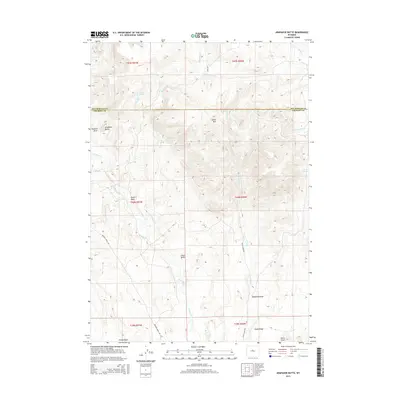
2015 Map of Arapahoe Butte
USGS Topo · Published 2015About this map
Arapahoe Butte and Chalk Butte anchor a landscape defined by deep erosional drainage systems and high ridges in this section of Fremont and Hot Springs counties. The terrain is deeply incised by multiple ephemeral watercourses, notably Bridger Cr and its various forks, alongside Lysite Cr which cuts through the eastern portion of the survey. Isolated water sources like Willow Spring and Puzzle Spring are critical landmarks in this arid environment, often indicating historical stopping points for travelers and livestock. The 2015 data illustrates a sparse settlement pattern dominated by grazing and ranching, with Noble Ridge and Lysite Mtn providing prominent elevation points above the many named draws, including Maxwell Draw and the descriptively named Poison Draw. Transportation remains limited to primitive corridors like Bridger Creek Rd and Reck Rd, which follow the natural contours of the drainages.
Find a feature on this map
29 named features on this map. Tap any name to fly to it.
Don’t see what you’re looking for? This feature index may not catch every label — zoom into the map to look around manually.
Map Details
Editions of this 2015 Arapahoe Butte Map
This is the sole edition of this map. No revisions or reprints were ever made.
Other maps of this area

1952 · Gates Butte
USGS Topo · 1:24,000

1952 · Cottonwood Pass
USGS Topo · 1:24,000

1952 · Rathbun Ranch
USGS Topo · 1:24,000

1952 · Lysite
USGS Topo · 1:24,000

1952 · Lysite SE
USGS Topo · 1:24,000

1952 · Arapahoe Butte
USGS Topo · 1:24,000

1952 · De Pass
USGS Topo · 1:24,000

1952 · Battle Mountain
USGS Topo · 1:24,000

1952 · Bull Mountain
USGS Topo · 1:24,000

1955 · Arminto
USGS Topo · 1:250,000