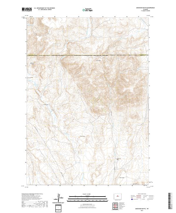
2021 Map of Arapahoe Butte
USGS Topo · Published 2021About this map
Arapahoe Butte and Lysite Mtn dominate this high-elevation Wyoming landscape where the borders of Hot Springs and Fremont counties meet. This modern survey illustrates the rugged drainage systems of the Wind River Basin, defined by the winding paths of Bridger Creek and Lysite Creek. The terrain is characterized by a network of seasonal watercourses and topographic landmarks like Chalk Butte and Noble Ridge, suggesting a land shaped by erosion and long-standing ranching pathways.
Find a feature on this map
26 named features on this map. Tap any name to fly to it.
Don’t see what you’re looking for? This feature index may not catch every label — zoom into the map to look around manually.
Map Details
Editions of this 2021 Arapahoe Butte Map
This is the sole edition of this map. No revisions or reprints were ever made.
Other maps of this area

1952 · Gates Butte
USGS Topo · 1:24,000

1952 · Cottonwood Pass
USGS Topo · 1:24,000

1952 · Rathbun Ranch
USGS Topo · 1:24,000

1952 · Lysite
USGS Topo · 1:24,000

1952 · Lysite SE
USGS Topo · 1:24,000

1952 · Arapahoe Butte
USGS Topo · 1:24,000

1952 · De Pass
USGS Topo · 1:24,000

1952 · Battle Mountain
USGS Topo · 1:24,000

1952 · Bull Mountain
USGS Topo · 1:24,000

1955 · Arminto
USGS Topo · 1:250,000