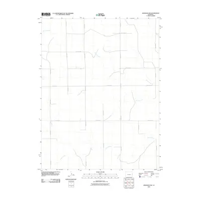
2010 Map of Arapahoe NW
USGS Topo · Published 2010About this map
The Smoky Hill River winds through the southern portion of this High Plains landscape, a primary drainage feature in a region defined by its vast, open character. In the northern reaches, Big Timber Creek carves a path across the terrain, illustrating the natural watershed patterns of eastern Colorado. The map reveals a highly structured grid of section lines and rural transport routes, including County Road Z, County Road X, and County Rd 50. These numbered and lettered routes trace the development of the agricultural landscape, where the intersection of water and access dictated land use. This 2010 survey provides a clear view of the regional connectivity provided by the local road system, including the parallel paths of County Road BB and County Road AA through the central part of the quadrangle.
Find a feature on this map
13 named features on this map. Tap any name to fly to it.
Don’t see what you’re looking for? This feature index may not catch every label — zoom into the map to look around manually.
Map Details
Editions of this 2010 Arapahoe NW Map
This is the sole edition of this map. No revisions or reprints were ever made.
Other maps of this area

1892 · Cheyenne Wells
USGS Topo · 1:125,000

1894 · Cheyenne Wells
USGS Topo · 1:125,000

1954 · Limon
USGS Topo · 1:250,000

1954 · Lamar
USGS Topo · 1:250,000

1957 · Limon
USGS Topo · 1:250,000

1958 · Limon
USGS Topo · 1:250,000

1958 · Lamar
USGS Topo · 1:250,000

1969 · Arapahoe SE
USGS Topo · 1:24,000
1969 · Arapahoe NE
USGS Topo · 1:24,000

1969 · Mount Sunflower SW
USGS Topo · 1:24,000