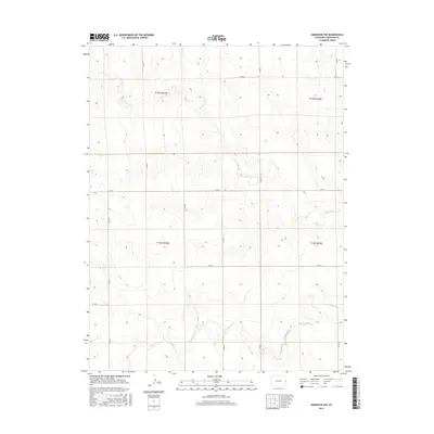
2016 Map of Arapahoe NW
USGS Topo · Published 2016About this map
Smoky Hill River winds across the southern reaches of this High Plains landscape in Cheyenne County, providing a critical water source in a region defined by its wide, open drainage patterns. The ephemeral Big Timber Cr cuts through the northern and central sections, carving subtle relief into the terrain as it trends southeast toward the river. This 2016 survey illustrates the persistent section-line grid system of the rural West, with a network of maintained local routes like Co Rd Cc and Co Rd Z facilitating transit across the expansive agricultural and grazing lands. The map detail reflects the long-standing public land survey system divisions, including t12s r43w and t13s r42w, which have dictated the settlement and ownership patterns of this eastern Colorado prairie for over a century.
Find a feature on this map
16 named features on this map. Tap any name to fly to it.
Don’t see what you’re looking for? This feature index may not catch every label — zoom into the map to look around manually.
Map Details
Editions of this 2016 Arapahoe NW Map
This is the sole edition of this map. No revisions or reprints were ever made.
Other maps of this area

1892 · Cheyenne Wells
USGS Topo · 1:125,000

1894 · Cheyenne Wells
USGS Topo · 1:125,000

1954 · Limon
USGS Topo · 1:250,000

1954 · Lamar
USGS Topo · 1:250,000

1957 · Limon
USGS Topo · 1:250,000

1958 · Limon
USGS Topo · 1:250,000

1958 · Lamar
USGS Topo · 1:250,000

1969 · Arapahoe SE
USGS Topo · 1:24,000
1969 · Arapahoe NE
USGS Topo · 1:24,000

1969 · Mount Sunflower SW
USGS Topo · 1:24,000