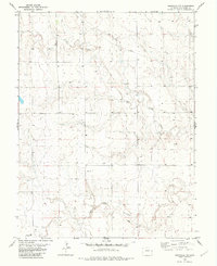
1982 Map of Arapahoe NW
USGS Topo · Published 1982About this map
Smoky Hill River meanders across the southern portion of this High Plains landscape, marking a distinct geographical transition in Cheyenne County. In this arid stretch of eastern Colorado, the terrain is defined by the drainage of Big Timber Creek, which cuts through the central sections of the survey. The small settlement of Pelton serves as a primary point of interest for genealogists and local historians tracking rural development in the late twentieth century. Economic activity in the region is evidenced by the presence of a Gravel Pit near the river and scattered agricultural infrastructure, including Storage Bins and numerous Wells. The placement of these features suggests a landscape deeply tied to water management and extraction during the early 1980s.
Find a feature on this map
9 named features on this map. Tap any name to fly to it.
Don’t see what you’re looking for? This feature index may not catch every label — zoom into the map to look around manually.
Map Details
Editions of this 1982 Arapahoe NW Map
This is the sole edition of this map. No revisions or reprints were ever made.
Other maps of this area

1892 · Cheyenne Wells
USGS Topo · 1:125,000

1894 · Cheyenne Wells
USGS Topo · 1:125,000

1954 · Limon
USGS Topo · 1:250,000

1954 · Lamar
USGS Topo · 1:250,000

1957 · Limon
USGS Topo · 1:250,000

1958 · Limon
USGS Topo · 1:250,000

1958 · Lamar
USGS Topo · 1:250,000

1969 · Arapahoe SE
USGS Topo · 1:24,000
1969 · Arapahoe NE
USGS Topo · 1:24,000

1969 · Mount Sunflower SW
USGS Topo · 1:24,000