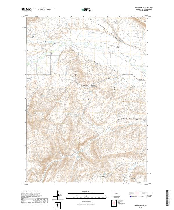
2021 Map of Arapahoe Ranch
USGS Topo · Published 2021About this map
Arapahoe Ranch anchors the northern drainage of the Owl Creek mountains in this high-altitude landscape of Hot Springs County. The terrain is defined by dramatic elevation changes, from the flat-topped Little Table Mtn in the south to the sweeping Padlock Rim on the northeastern horizon. Water sources are critical landmarks in this arid environment, evidenced by numerous named seeps such as Knight Spring, Love Spring, and Chokecherry Spring. These springs and the riparian corridors of Owl Cr and its forks have historically dictated the movement of livestock and the placement of ranching infrastructure. Modern access follows older corridors like Merritt Pass Rd and Red Canyon Rd, which navigate the complex system of draws and ridges, including the prominent Blue Ridge. This 2021 update documents the persistent ranching footprint in a region where geography remains the primary driver of human activity.
Find a feature on this map
36 named features on this map. Tap any name to fly to it.
Don’t see what you’re looking for? This feature index may not catch every label — zoom into the map to look around manually.
Map Details
Editions of this 2021 Arapahoe Ranch Map
This is the sole edition of this map. No revisions or reprints were ever made.
Other maps of this area

1913 · Grass Creek Basin
USGS Topo · 1:62,500

1914 · Blue Mesa
USGS Topo · 1:62,500

1915 · Grass Creek Basin
USGS Topo · 1:62,500

1916 · Blue Mesa
USGS Topo · 1:62,500

1952 · Kates Basin
USGS Topo · 1:24,000

1952 · Sheep Ridge
USGS Topo · 1:24,000

1955 · Thermopolis
USGS Topo · 1:250,000

1958 · Thermopolis
USGS Topo · 1:250,000

1962 · Thermopolis
USGS Topo · 1:250,000

1965 · Arapahoe Ranch
USGS Topo · 1:24,000