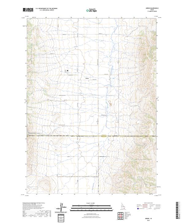
2023 Map of Arbon
USGS Topo · Published 2023About this map
Arbon Valley serves as the central corridor for this rural community, where agricultural life is defined by the steady flow of Bannock Creek. The landscape is framed by the Deep Creek Mountains to the west and the Pleasantview Hills to the southeast, creating a distinct topographical basin. The small settlement of Arbon sits at a junction of local thoroughfares, including Church Rd and Cemetery Rd, which lead to the Arbon Valley Cem. The mapping of family-named routes such as Roderick Ln, Bailey Rd, and Andersen Rd illustrates a legacy of local landholding and historical homesteading patterns. This 2023 edition also documents the jurisdictional boundary where the Power County line meets Oneida County near Phelps Rd.
Find a feature on this map
25 named features on this map. Tap any name to fly to it.
Don’t see what you’re looking for? This feature index may not catch every label — zoom into the map to look around manually.
Map Details
Editions of this 2023 Arbon Map
This is the sole edition of this map. No revisions or reprints were ever made.
Other maps of this area

1938 · Pauline
USGS Topo · 1:48,000

1944 · Arbon
USGS Topo · 1:62,500

1954 · Pocatello
USGS Topo · 1:250,000

1958 · Pocatello
USGS Topo · 1:250,000

1963 · Daniels
USGS Topo · 1:24,000

1968 · Daniels
USGS Topo · 1:24,000

1968 · Dairy Creek
USGS Topo · 1:24,000

1968 · Bradley Mtn
USGS Topo · 1:24,000

1971 · Bannock Peak
USGS Topo · 1:24,000
1971 · Pauline
USGS Topo · 1:24,000