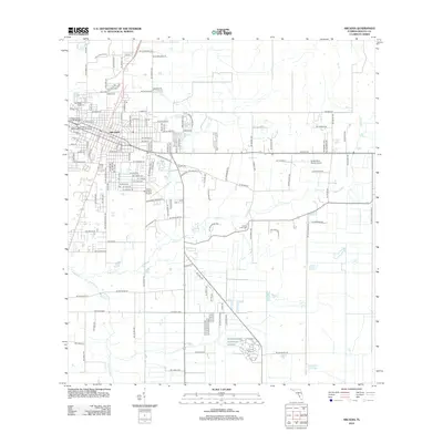
2012 Map of Arcadia
USGS Topo · Published 2012About this map
Arcadia serves as the focal point of this DeSoto County landscape, centered at the intersection of a sprawling rural road network and the meandering course of Joshua Cr. The town's infrastructure is clearly defined, including the City of Arcadia William Tyson Wastewater Treatment Facility and the Arcadia Municipal Airport south of the main settlement. For those tracing local history, the map identifies several significant resting places and crossings, such as Oak Ridge Cem to the northwest and Joshua Creek Cem situated near the creek's bend. The transition from the structured street grid of the town to the open lands is marked by features like the Bright Hour Ranch Airport and the Chesterfield-Smith Bridge, while the southern reaches are defined by the natural drainage of Hawthorne Cr and the isolated waters of Deep Lake.
Find a feature on this map
141 named features on this map. Tap any name to fly to it.
Don’t see what you’re looking for? This feature index may not catch every label — zoom into the map to look around manually.
Map Details
Editions of this 2012 Arcadia Map
This is the sole edition of this map. No revisions or reprints were ever made.
Other maps of this area

1956 · Gardner
USGS Topo · 1:24,000

1956 · Arcadia SE
USGS Topo · 1:24,000

1956 · Limestone
USGS Topo · 1:24,000

1956 · Ft. Ogden
USGS Topo · 1:24,000

1956 · Nocatee
USGS Topo · 1:24,000

1956 · Crewsville SW
USGS Topo · 1:24,000

1956 · Long Island Marsh SW
USGS Topo · 1:24,000

1956 · Fort Pierce
USGS Topo · 1:250,000

1957 · Long Island Marsh NW
USGS Topo · 1:24,000

1957 · Arcadia
USGS Topo · 1:24,000