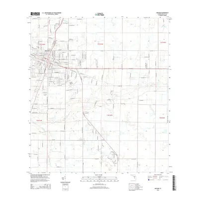
2015 Map of Arcadia
USGS Topo · Published 2015About this map
The street grid of Arcadia dominates the northwestern corner of this Florida interior landscape, where urban development meets the agricultural and hydrologic patterns of DeSoto County. Local history is anchored by the Oak Ridge Cem and the more remote Joshua Creek Cem, which sits along the winding course of Joshua Cr. The town's growth is represented by the Arcadia Municipal Airport and the sprawling residential layout of Arcadia Village. Natural water features including Lake Katherine, Deep Lake, and McBride Br break up the rectangular Public Land Survey System sections. The map traces the transition from dense neighborhood blocks like SW ML King Jr St to expansive rural tracts defined by drainage creeks such as Hawthorne Cr.
Find a feature on this map
159 named features on this map. Tap any name to fly to it.
Don’t see what you’re looking for? This feature index may not catch every label — zoom into the map to look around manually.
Map Details
Editions of this 2015 Arcadia Map
This is the sole edition of this map. No revisions or reprints were ever made.
Other maps of this area

1956 · Gardner
USGS Topo · 1:24,000

1956 · Arcadia SE
USGS Topo · 1:24,000

1956 · Limestone
USGS Topo · 1:24,000

1956 · Ft. Ogden
USGS Topo · 1:24,000

1956 · Nocatee
USGS Topo · 1:24,000

1956 · Crewsville SW
USGS Topo · 1:24,000

1956 · Long Island Marsh SW
USGS Topo · 1:24,000

1956 · Fort Pierce
USGS Topo · 1:250,000

1957 · Long Island Marsh NW
USGS Topo · 1:24,000

1957 · Arcadia
USGS Topo · 1:24,000