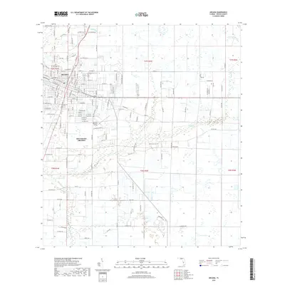
2018 Map of Arcadia
USGS Topo · Published 2018About this map
Arcadia serves as the focal point of this DeSoto County landscape, where the established town grid transitions into the sprawling residential and light industrial outskirts of Southeast Arcadia. The geographic character of the region is defined by the winding course of Joshua Creek, which snakes through the central and eastern portions of the quadrangle. Local infrastructure is anchored by the Arcadia Municipal Airport and a network of arterial roads like Macon Road and NW Livingston Street that connect the town to surrounding citrus groves and agricultural lands.
Find a feature on this map
69 named features on this map. Tap any name to fly to it.
Don’t see what you’re looking for? This feature index may not catch every label — zoom into the map to look around manually.
Map Details
Editions of this 2018 Arcadia Map
This is the sole edition of this map. No revisions or reprints were ever made.
Other maps of this area

1956 · Gardner
USGS Topo · 1:24,000

1956 · Arcadia SE
USGS Topo · 1:24,000

1956 · Limestone
USGS Topo · 1:24,000

1956 · Ft. Ogden
USGS Topo · 1:24,000

1956 · Nocatee
USGS Topo · 1:24,000

1956 · Crewsville SW
USGS Topo · 1:24,000

1956 · Long Island Marsh SW
USGS Topo · 1:24,000

1956 · Fort Pierce
USGS Topo · 1:250,000

1957 · Long Island Marsh NW
USGS Topo · 1:24,000

1957 · Arcadia
USGS Topo · 1:24,000