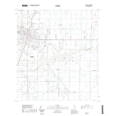
2021 Map of Arcadia
USGS Topo · Published 2021About this map
The DeSoto County Courthouse serves as the focal point of Arcadia, anchoring a structured grid of residential streets and civic infrastructure in this southern Florida landscape. The town is flanked by water systems, including the winding path of Joshua Creek to the south and Lake Katherine to the west. While the urban center is well-defined, the outlying areas of Southeast Arcadia and the surrounding township lines reveal a transition into more open terrain, punctuated by aviation activity at the Arcadia Municipal Airport. Genealogists and local researchers will find value in the documentation of local burial grounds such as Oak Ridge Cem and Joshua Creek Cem, which sit alongside drainage features like McBride Br and Hawthorne Creek that have long influenced the region's development and land use patterns.
Find a feature on this map
86 named features on this map. Tap any name to fly to it.
Don’t see what you’re looking for? This feature index may not catch every label — zoom into the map to look around manually.
Map Details
Editions of this 2021 Arcadia Map
This is the sole edition of this map. No revisions or reprints were ever made.
Other maps of this area

1956 · Gardner
USGS Topo · 1:24,000

1956 · Arcadia SE
USGS Topo · 1:24,000

1956 · Limestone
USGS Topo · 1:24,000

1956 · Ft. Ogden
USGS Topo · 1:24,000

1956 · Nocatee
USGS Topo · 1:24,000

1956 · Crewsville SW
USGS Topo · 1:24,000

1956 · Long Island Marsh SW
USGS Topo · 1:24,000

1956 · Fort Pierce
USGS Topo · 1:250,000

1957 · Long Island Marsh NW
USGS Topo · 1:24,000

1957 · Arcadia
USGS Topo · 1:24,000