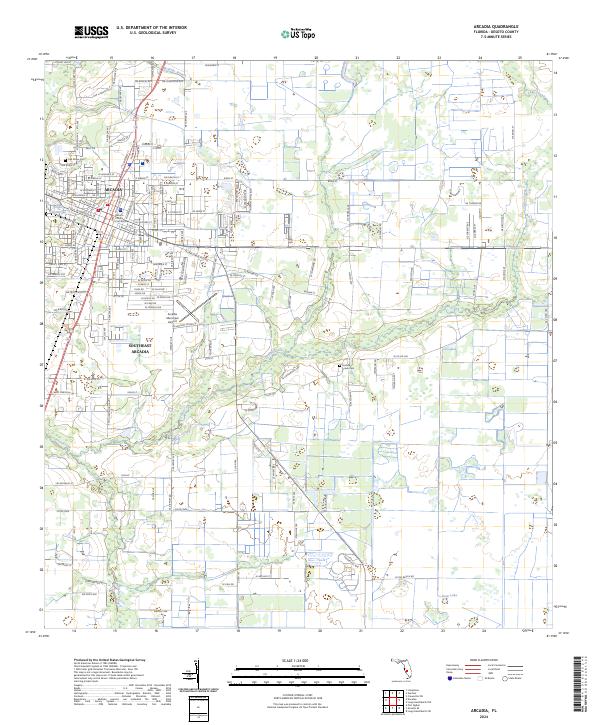
2024 Map of Arcadia
USGS Topo · Published 2024About this map
Arcadia serves as the regional hub for DeSoto County, defined by its historic core and the surrounding agricultural landscape. The DeSoto County Courthouse stands at the center of a dense street grid, while the residential expansion into Southeast Arcadia reflects the community's growth. The natural geography is shaped by water, with McBride Branch and Joshua Creek winding through the terrain, and smaller bodies such as Lake Katherine and Deep Lake dotting the south. This survey captures a modern look at the county seat, where traditional infrastructure like the Oak Ridge Cem meets essential aviation services at the Arcadia Municipal Airport. The map documents the persistent layout of township and range lines across Florida’s interior, including the transition from t37s r25e to t38s r25e.
Find a feature on this map
158 named features on this map. Tap any name to fly to it.
Don’t see what you’re looking for? This feature index may not catch every label — zoom into the map to look around manually.
Map Details
Editions of this 2024 Arcadia Map
This is the sole edition of this map. No revisions or reprints were ever made.
Other maps of this area

1956 · Gardner
USGS Topo · 1:24,000

1956 · Arcadia SE
USGS Topo · 1:24,000

1956 · Limestone
USGS Topo · 1:24,000

1956 · Ft. Ogden
USGS Topo · 1:24,000

1956 · Nocatee
USGS Topo · 1:24,000

1956 · Crewsville SW
USGS Topo · 1:24,000

1956 · Long Island Marsh SW
USGS Topo · 1:24,000

1956 · Fort Pierce
USGS Topo · 1:250,000

1957 · Long Island Marsh NW
USGS Topo · 1:24,000

1957 · Arcadia
USGS Topo · 1:24,000