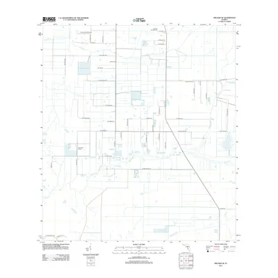
2012 Map of Arcadia SE
USGS Topo · Published 2012About this map
Carlstrom Field Airport and De Soto Aircraft Field anchor the northern reaches of this landscape, reflecting a region defined by its aviation history and managed agriculture. The terrain is a complex network of drainage and irrigation, where Prairie Cr and Myrtle Slough wind through a grid of rural roads and residential lanes. This 2012 survey illustrates the transition from traditional Florida wetlands like Hog Bay to structured development, seen in the proliferation of named drives and terraces such as Se Piggyback Rd and Se Tiger Bay Dr. Centered near Hennessy Airport, the map provides a look at how the interior of the state has been partitioned into large plots, interspersed with creeks like Hawthorne Cr that continue to shape the local geography.
Find a feature on this map
48 named features on this map. Tap any name to fly to it.
Don’t see what you’re looking for? This feature index may not catch every label — zoom into the map to look around manually.
Map Details
Editions of this 2012 Arcadia SE Map
This is the sole edition of this map. No revisions or reprints were ever made.
Other maps of this area

1956 · Arcadia SE
USGS Topo · 1:24,000

1956 · Cleveland
USGS Topo · 1:24,000

1956 · Telegraph Swamp NW
USGS Topo · 1:24,000

1956 · Ft. Ogden
USGS Topo · 1:24,000

1956 · Nocatee
USGS Topo · 1:24,000

1956 · Long Island Marsh SW
USGS Topo · 1:24,000

1956 · Bermont
USGS Topo · 1:24,000

1956 · West Palm Beach
USGS Topo · 1:250,000

1956 · Fort Pierce
USGS Topo · 1:250,000

1957 · West Palm Beach
USGS Topo · 1:250,000