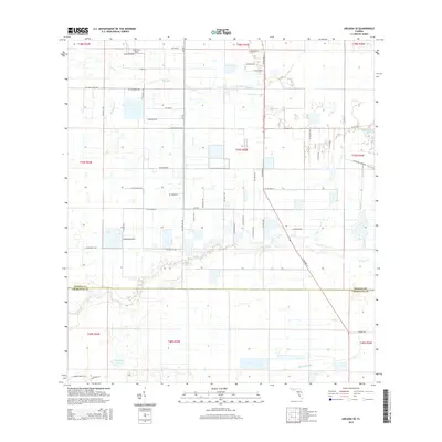
2015 Map of Arcadia SE
USGS Topo · Published 2015About this map
Carlstrom Field anchors the northern portion of this landscape where the borders of Desoto Co and Charlotte Co meet. The terrain is defined by a grid of rural roads and the meandering path of Prairie Cr, which snakes across the central plains toward the southwest. This area reflects a specialized aviation and agricultural history, with the presence of Hennessy Airport and numerous rural access routes like SE Shell Pit Rd and SE Timber Dr. Significant wetland features including Hog Bay and the drainage of Myrtle Slough interrupt the strictly surveyed land sections, illustrating the persistent influence of Florida's hydrology on local development. Small bodies of water such as Thimble Lake and Pine Island Lake dot the eastern and southern reaches, highlighting the varied aquatic character of this inland territory.
Find a feature on this map
41 named features on this map. Tap any name to fly to it.
Don’t see what you’re looking for? This feature index may not catch every label — zoom into the map to look around manually.
Map Details
Editions of this 2015 Arcadia SE Map
This is the sole edition of this map. No revisions or reprints were ever made.
Other maps of this area

1956 · Arcadia SE
USGS Topo · 1:24,000

1956 · Cleveland
USGS Topo · 1:24,000

1956 · Telegraph Swamp NW
USGS Topo · 1:24,000

1956 · Ft. Ogden
USGS Topo · 1:24,000

1956 · Nocatee
USGS Topo · 1:24,000

1956 · Long Island Marsh SW
USGS Topo · 1:24,000

1956 · Bermont
USGS Topo · 1:24,000

1956 · West Palm Beach
USGS Topo · 1:250,000

1956 · Fort Pierce
USGS Topo · 1:250,000

1957 · West Palm Beach
USGS Topo · 1:250,000