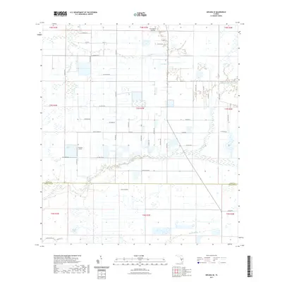
2021 Map of Arcadia SE
USGS Topo · Published 2021About this map
Hummingbirds Landing and the small airstrip at Hennessy Airport anchor the northern landscape of this rural Florida interior, where the border between DeSoto and Charlotte Counties divides a complex network of wetlands and cattle ranches. The topography is defined by slow-moving water systems, including the expansive Hog Bay and the winding Myrtle Slough, which drain through the flat pastureland. Roads like Ryals Ranch Rd and Co Rd 763 provide access to dispersed agricultural operations and localized settlements such as Mehl. This 2021 survey illustrates a region largely characterized by large-tract land use and water management, visible in the numerous drainage channels and named water bodies like Pine Island Lake and Thimble Lake that punctuate the grid of section lines and range markers.
Find a feature on this map
58 named features on this map. Tap any name to fly to it.
Don’t see what you’re looking for? This feature index may not catch every label — zoom into the map to look around manually.
Map Details
Editions of this 2021 Arcadia SE Map
This is the sole edition of this map. No revisions or reprints were ever made.
Other maps of this area

1956 · Arcadia SE
USGS Topo · 1:24,000

1956 · Cleveland
USGS Topo · 1:24,000

1956 · Telegraph Swamp NW
USGS Topo · 1:24,000

1956 · Ft. Ogden
USGS Topo · 1:24,000

1956 · Nocatee
USGS Topo · 1:24,000

1956 · Long Island Marsh SW
USGS Topo · 1:24,000

1956 · Bermont
USGS Topo · 1:24,000

1956 · West Palm Beach
USGS Topo · 1:250,000

1956 · Fort Pierce
USGS Topo · 1:250,000

1957 · West Palm Beach
USGS Topo · 1:250,000