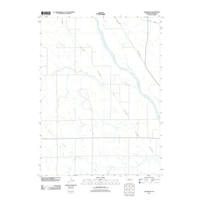
2011 Map of Arcadia SE
USGS Topo · Published 2011About this map
The Middle Loup River dominates this section of Sherman County, its wide, braided channel cutting a path southeast through the Nebraska plains. This 2011 survey illustrates a landscape heavily defined by water management and irrigation, most notably through the engineered paths of Canal Number 3 and Canal Number 4. These man-made waterways run roughly parallel to the river's course, intersecting the natural drainage of seasonal streams like Hays Creek and Cole Creek. The map provides a clear picture of the rural section-line road grid that overlays the undulating terrain, revealing how agricultural boundaries interact with the meandering flows of Moon Creek and Cob Creek in the southern portion of the quadrangle.
Find a feature on this map
7 named features on this map. Tap any name to fly to it.
Don’t see what you’re looking for? This feature index may not catch every label — zoom into the map to look around manually.
Map Details
Editions of this 2011 Arcadia SE Map
This is the sole edition of this map. No revisions or reprints were ever made.
Other maps of this area

1899 · Loup
USGS Topo · 1:125,000

1951 · Arcadia SE
USGS Topo · 1:24,000

1951 · Litchfield NE
USGS Topo · 1:24,000

1951 · Arcadia West
USGS Topo · 1:24,000

1951 · Arcadia East
USGS Topo · 1:24,000

1951 · Arcadia SW
USGS Topo · 1:24,000

1951 · Litchfield
USGS Topo · 1:24,000

1953 · Loup City NW
USGS Topo · 1:24,000

1953 · Ravenna NW
USGS Topo · 1:24,000

1953 · Loup City
USGS Topo · 1:24,000