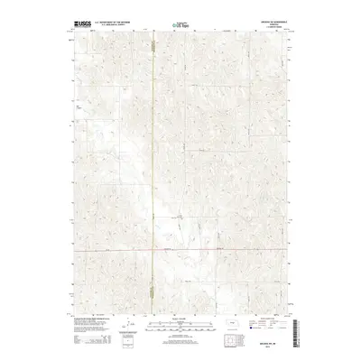
2014 Map of Arcadia SW
USGS Topo · Published 2014About this map
The rolling loess hills of central Nebraska define this landscape where Custer Co and Sherman Co meet. The terrain is deeply incised by the seasonal drainages of Clear Creek, which carves through the central and western portions of the quadrangle. In the northwestern corner, Ash Canyon provides a significant break in the topography. A lone point of human interest, the Lone Elm Cem, is situated along 791st Rd, serving as a silent record of early settlement patterns in this agricultural region. Transportation across these ridgelines is anchored by Highway 92 (also labeled Ne-92), which cuts a straight east-west line across the southern third of the map. The remaining landscape is organized by a strictly oriented grid of section-line roads, including 462nd Ave and 464th Ave, reflecting the enduring influence of the Public Land Survey System on the Nebraska prairie.
Find a feature on this map
16 named features on this map. Tap any name to fly to it.
Don’t see what you’re looking for? This feature index may not catch every label — zoom into the map to look around manually.
Map Details
Editions of this 2014 Arcadia SW Map
This is the sole edition of this map. No revisions or reprints were ever made.
Other maps of this area

1951 · Ansley NE
USGS Topo · 1:24,000

1951 · Arcadia SE
USGS Topo · 1:24,000

1951 · Litchfield NE
USGS Topo · 1:24,000

1951 · Arcadia West
USGS Topo · 1:24,000

1951 · Arcadia East
USGS Topo · 1:24,000

1951 · Mason City
USGS Topo · 1:24,000

1951 · Ansley SE
USGS Topo · 1:24,000

1951 · Arcadia SW
USGS Topo · 1:24,000

1951 · Litchfield
USGS Topo · 1:24,000

1955 · Broken Bow
USGS Topo · 1:250,000