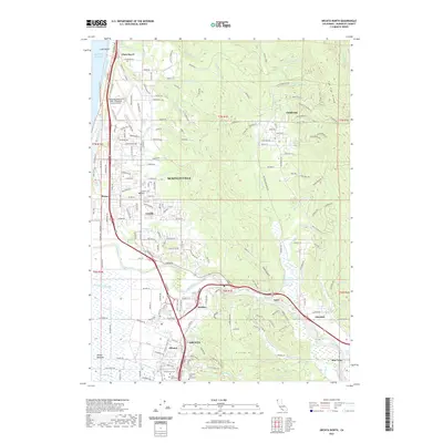
2021 Map of Arcata North
USGS Topo · Published 2021About this map
Arcata and the surrounding Arcata Bottoms anchor this northern California landscape where the Mad River meets the Pacific coast. The map illustrates a transition from the urban footprint of Humboldt State University and the residential corridors of McKinleyville to the timbered heights of Tip Top Ridge and Fickle Hill. Transportation and infrastructure are central to the area's development, featuring the California Redwood Coast-Humboldt County Airport near Clam Beach and the winding course of Central Ave connecting localized settlements. Genealogists and local historians will find several key landmarks preserved, including Greenwood Cem and Saint Mary's Cem. Smaller rural communities like Fieldbrook, Essex, and Korblex are documented alongside the drainage systems of Widow White Cr and Lindsay Cr, which define the low-lying coastal plains and interior valleys.
Find a feature on this map
136 named features on this map. Tap any name to fly to it.
Don’t see what you’re looking for? This feature index may not catch every label — zoom into the map to look around manually.
Map Details
Editions of this 2021 Arcata North Map
This is the sole edition of this map. No revisions or reprints were ever made.
Other maps of this area

1922 · Eureka
USGS Topo · 1:62,500

1922 · Korbel
USGS Topo · 1:62,500

1925 · Hoopa
USGS Topo · 1:125,000

1933 · Eureka
USGS Topo · 1:48,000

1942 · Eureka
USGS Topo · 1:62,500

1945 · Trinidad
USGS Topo · 1:62,500

1945 · Coyote Peak
USGS Topo · 1:62,500

1945 · Blue Lake
USGS Topo · 1:62,500

1948 · Weed
USGS Topo · 1:250,000

1949 · Eureka
USGS Topo · 1:250,000