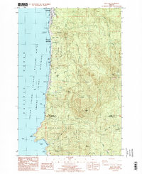
1985 Map of Arch Cape
USGS Topo · Published 1985About this map
Tolovana Park and the small settlement of Arch Cape anchor this coastal landscape, which is defined by a dense network of state-protected lands and rugged maritime landmarks. The shoreline features numerous named headlands and rock formations, such as Silver Point, Humbug Point, and the prominent Cape Falcon to the south. Between these points, public access is maintained through a series of preserves including Arcadia Beach State Wayside, Hug Point State Park, and the expansive Oswald D West State Park.
Find a feature on this map
53 named features on this map. Tap any name to fly to it.
Don’t see what you’re looking for? This feature index may not catch every label — zoom into the map to look around manually.
Map Details
Editions of this 1985 Arch Cape Map
2 editions found
Other maps of this area

1937 · Nehalem
USGS Topo · 1:62,500

1940 · Cape Falcon
USGS Topo · 1:62,500

1943 · Nehalem
USGS Topo · 1:62,500

1948 · Vancouver
USGS Topo · 1:250,000

1949 · Tillamook Head
USGS Topo · 1:24,000

1950 · Vancouver
USGS Topo · 1:250,000

1950 · Vancouver
USGS Topo · 1:250,000

1955 · Nehalem
USGS Topo · 1:62,500
1955 · Cannon Beach
USGS Topo · 1:62,500

1958 · Vancouver
USGS Topo · 1:250,000