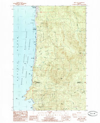
1985 Map of Arch Cape
USGS Topo · Published 1985About this map
Arch Cape and the coastal settlements of the northern Oregon shore are meticulously documented in this mid-1980s provisional survey. The landscape is defined by the proximity of the coastal mountains to the Pacific Ocean, where prominent landmarks such as Silver Point, Jockey Cap, and Humbug Point overlook the surf. Inland, the terrain rises sharply toward Angora Peak and Onion Peak, drained by a network of waterways including Arch Cape Creek and North Fork Ecola Creek.
Find a feature on this map
51 named features on this map. Tap any name to fly to it.
Don’t see what you’re looking for? This feature index may not catch every label — zoom into the map to look around manually.
Map Details
Editions of this 1985 Arch Cape Map
2 editions found
Other maps of this area

1937 · Nehalem
USGS Topo · 1:62,500

1940 · Cape Falcon
USGS Topo · 1:62,500

1943 · Nehalem
USGS Topo · 1:62,500

1948 · Vancouver
USGS Topo · 1:250,000

1949 · Tillamook Head
USGS Topo · 1:24,000

1950 · Vancouver
USGS Topo · 1:250,000

1950 · Vancouver
USGS Topo · 1:250,000

1955 · Nehalem
USGS Topo · 1:62,500
1955 · Cannon Beach
USGS Topo · 1:62,500

1958 · Vancouver
USGS Topo · 1:250,000